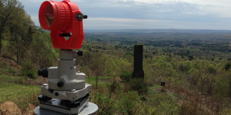
Working on a mountainside near Farmington, CT, our Hodge survey crew gets a nice view of the valley. In the foreground is our backsight prism, which we use as a point of reference for our total station. Just beyond it is an old stone chimney and the remains of a foundation for a home that has long since decayed. A goose had been nesting on the top of the chimney until moments before the photo was taken.


 As with all GPS technology, it has come a remarkably long way very quickly. And though it is still a long ways from being survey-grade acceptible in accuracy, it has an array of practical applications that are saving surveyors a lot of time and hassle.

 This week (December 2014), using some of the most advanced camera and laser scanning technologies, “[a] bust of President Obama was created by a Smithsonian-led team of 3D-digital-imaging specialists, Autodesk and 3D Systems, in collaboration with the University of Southern California’s Institute for Creative Technologies” (