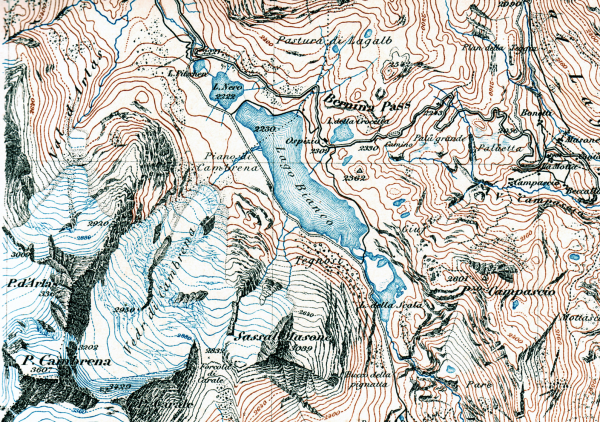
A Topographic Survey depicts the configuration (relief) of the earth’s surface and the location of natural and artificial objects theron. It is most often needed for site design work by engineers and landscape architects, or to show how closely a finished grade matches it’s corresponding design elevation at the site.
Whereas most topographic data is depicted with contour intervals greater than 10 feet, survey-grade data depicts contours much more frequently at usually less than 2 feet per contour. For the former, such information can be bought from aerial surveying companies. But for the later, use of a survey crew is necessary for such a higher degree of accuracy.
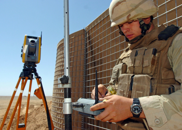
Use of our Trimble Robotic Total Station allows for quick, efficient and adaptable surveying.
How a typical topographic survey is conducted:
- Locate and “get-on” control at the site so that the instrument can know where it is.
- The senior surveyor/party chief assesses the site and quickly determines a plan of action for how best to map it.
- The survey crew takes “shots” (create points of data) in a grid-like pattern such that our processing software can extrapolate between these points to instantly create precise contour lines.
- Though much of the contour drafting is automated, additional drafting work is required to ensure the accuracy of the program, depict lines more clearly where needed, and show other information such as elevation benchmarks and coordinates.
- The map is reviewed, filed, and printed.