Why GHH? Ask Surveyor Calvin Weingart…

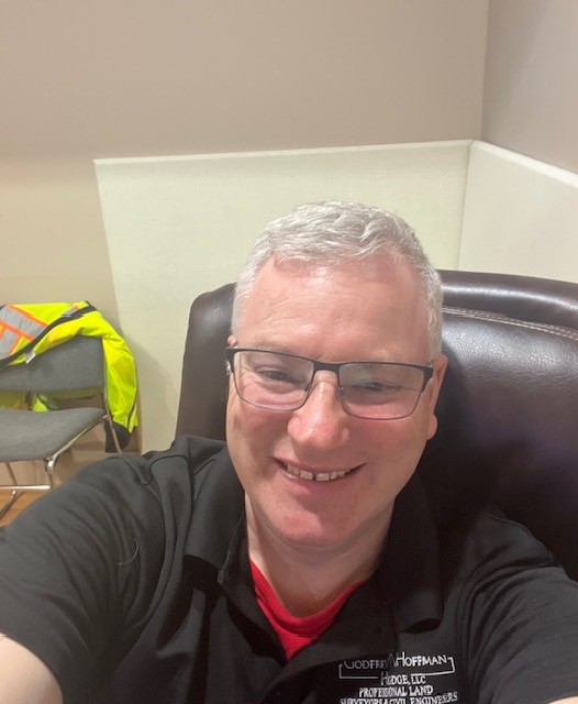
Meet Surveyor Calvin Weingart, P.L.S.

A Q & A with a 25 year veteran surveyor, Calvin finds passion and inspiration in his work and brings that to GHH’s clients on every project. 

How long have you worked at GHH?
I have worked here since June 15, 1998, so a little over 25 years.

What do you do and why do you do it?
I am a Professional Licensed Land Surveyor.  I do it because it is a good mix of outdoor physical activity and indoor intellectual activity.   I’ve been the Survey Manager at Godfrey Hoffman Hodge since 2015. I enjoy every aspect of the position from initial client contact to mission planning and execution to training and mentoring of survey technicians.

Why should someone seeking a survey contact GHH over your competitors?
I manage each job as I would want it managed if I was the client: consistent communication, performance to utmost ability, professionalism, patience. My goal is to minimize the chance the client will ask for an update.

What does a typical day look like for you?
I get in the office a little before 8 most days and review the plan of the day for our department.  I start mission briefs promptly at 8:00 and get the crew(s) ready to head out to the field.  If I am part of the field crew I gather files, gear and people and try to be out by 8:20 or so.  Between travel time and company hours there is only about 5 hours of onsite time so every minute counts in the morning.

If I am working in the office, I get the crew(s) launched out the door and start working on whatever task I have for myself that day.  This can range from survey computations, autocad drafting, land records research and quality review of completed surveys.  I have a dual mission in the form of staff and client support, so I am often switching from one function to another.

By about 2:30 or so I start thinking about the next day’s tasking to try and stay ahead of everyone so there is minimal down time and maximum efficiency.  By 3:30 the crew is usually back in, if they aren’t in already. They download the day’s data files and process all the info.  We attend to a few administrative chores such as time keeping and we wrap up at 4:30 with, hopefully, the next day planned out and all gear and files set to go.

What has changed during your career?
Technological advances in data collection, the availability of very accurate open-source data and municipal GIS.  All for the better or worse depending on your point of view.

What hasn’t changed?
The need for a professional surveyor’s expertise to verify measurements, the need to apply the rules of evidence and interpret boundary law and chopping line through dense brush on very hot days.

What’s the most interesting property you ever surveyed?
I  can’t name the exact property but I did get a chance to work in a very interesting location in the very heart of New Haven . Lets just say that we worked in spaces where some globally powerful people once socially  gathered in private.

What’s the hardest property you ever surveyed?
That is a subjective question! Some small parcels are very challenging with respect to forming a boundary opinion so the hard part is intellectual. On the other hand, some large parcels are physically demanding, such the 100 plus acres we surveyed in North Stonington.  I had two back to back days of walking 8 plus miles during one phase of the job. And there was the job this summer where we located and identified 612 trees.

What keeps you going back?
My job checks all the boxes for me: Physical work, intellectual work, technical expertise, mission planning, leadership, doing something that is a little offbeat that most people know a little about but not too much.  And finally, I am truly fortunate that I found a career in which you can start at the very bottom and work your way up to professional licensing through (I know this sounds quaint) hard work and dedication.

How Land Surveyors Set The Stage For A New Building

This Is How We Do It…

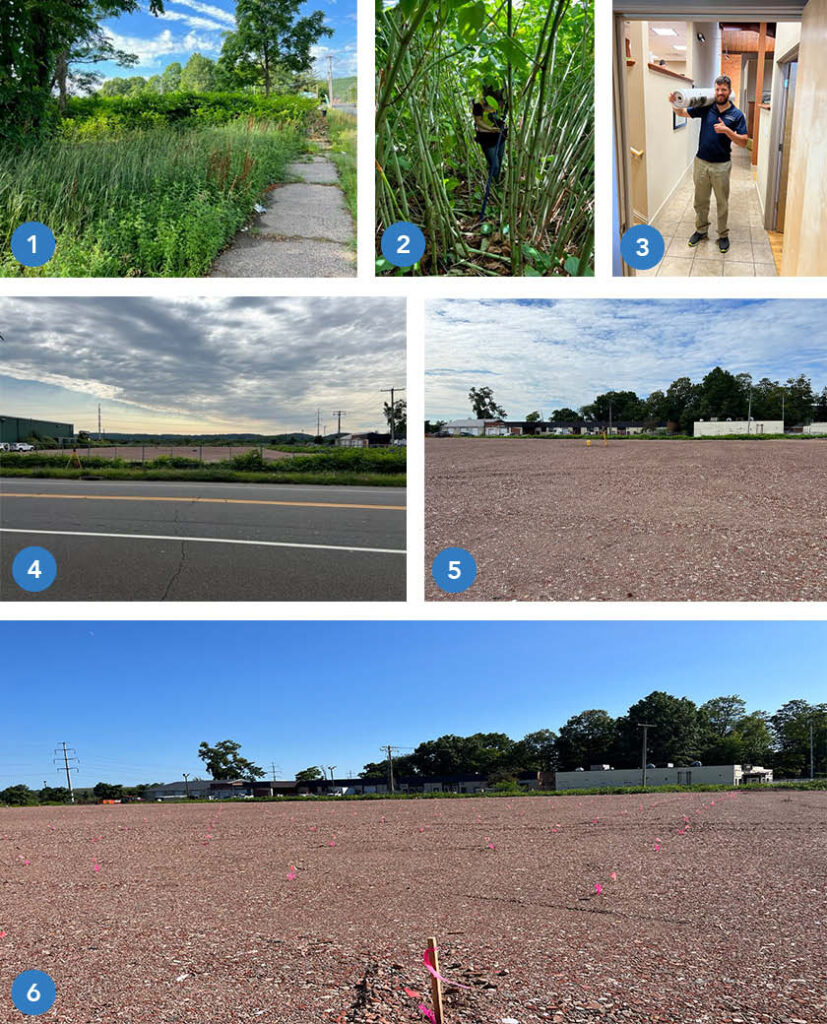
This sequential photo montage highlights all the phases involved in preparing a site for the construction of a new building.

  1.  The undeveloped, overgrown site in Hamden, CT at commencement of survey work.
  2.  Site conditions during field work with survey gear.  As we often do, our crew contends with towering, tangling vegetation.
  3.  A year later, after site design and the permitting process, the finished plan set is delivered to the town permitting agency.
  4.  The site is cleared and prepared for construction.
  5.  The crew and survey instrument are in position to locate and mark 384 points for Helical Pile installation.  (These piles, or piers, are used to stabilize soil to support the building foundation).
  6.  The pier stakeout is complete and the site is ready for the pile driving crew to commence work. Each location is identified by the  pink whisker flag and orange numerical identifier.

Once the piers are installed the foundation will be marked out for construction.

Stay tuned for updates as we follow this project to completion!

GHH Celebrates Calvin Weingart’s 25th Year!

Congratulations to Calvin Weingart, P.L.S.

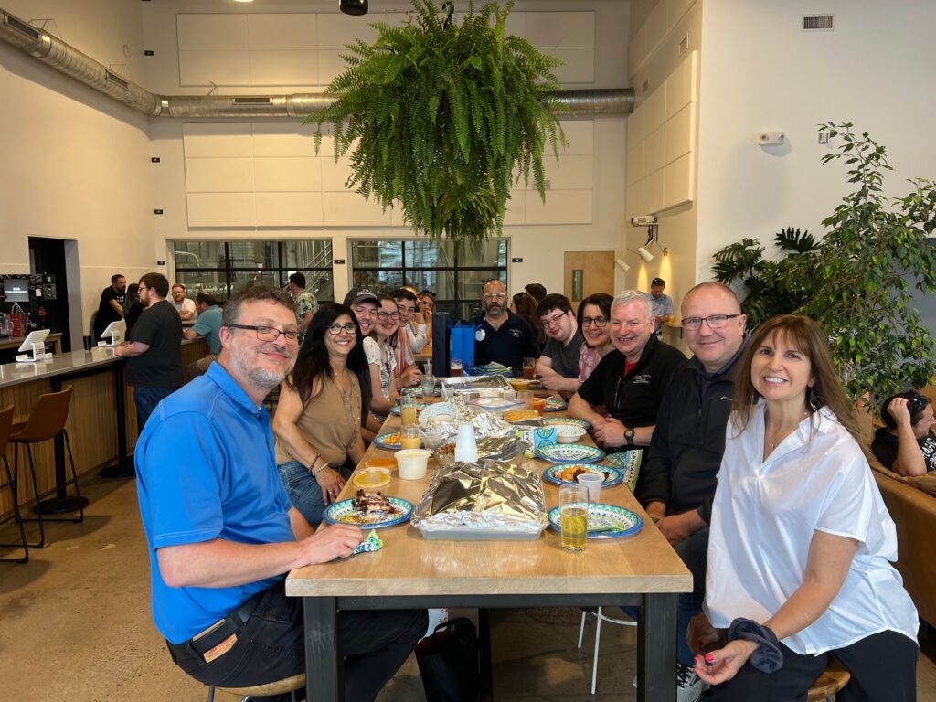
At Godrey Hoffman Hodge, we believe in recognizing and celebrating our employees’ milestones and achievements. Recently, we had the pleasure of honoring Calvin’s 25th year of outstanding service within our organization. This remarkable milestone not only signifies his unwavering dedication but also showcases the opportunities for growth and success at GHH.

Calvin’s impressive tenure at Godfrey Hoffman Hodge began 25 years ago when he was hired by none other than our esteemed founder, Bernard E. Godfrey. Recognizing Calvin’s strong work ethic and his experience growing up on a farm, he showed early on the tenacity and resilience required to excel in our industry. Today, he is a licensed land surveyor and Survey Manager, contributing to our success.

To celebrate, we organized a memorable get together at the 12% Brewery (a valued client of GHH), featuring delectable cuisine from Mikro. The event showcased our strong client relationships and sense of community. Calvin’s journey inspires us, emphasizing perseverance, growth, and excellence. As we honor this occasion, we anticipate a bright future and remarkable opportunities for our employees and organization. Together, we will create more memorable milestones in the future.

Side note: When asked for some words of wisdom on the occasion, Calvin (pictured third from right) had this to say: “I am grateful for all the opportunities presented to me and for the encouragement to pursue them. Beyond that, I am just happy to work here and drink some beers on the boss.

Tales From The Front Desk

How GHH Helps When You Call…

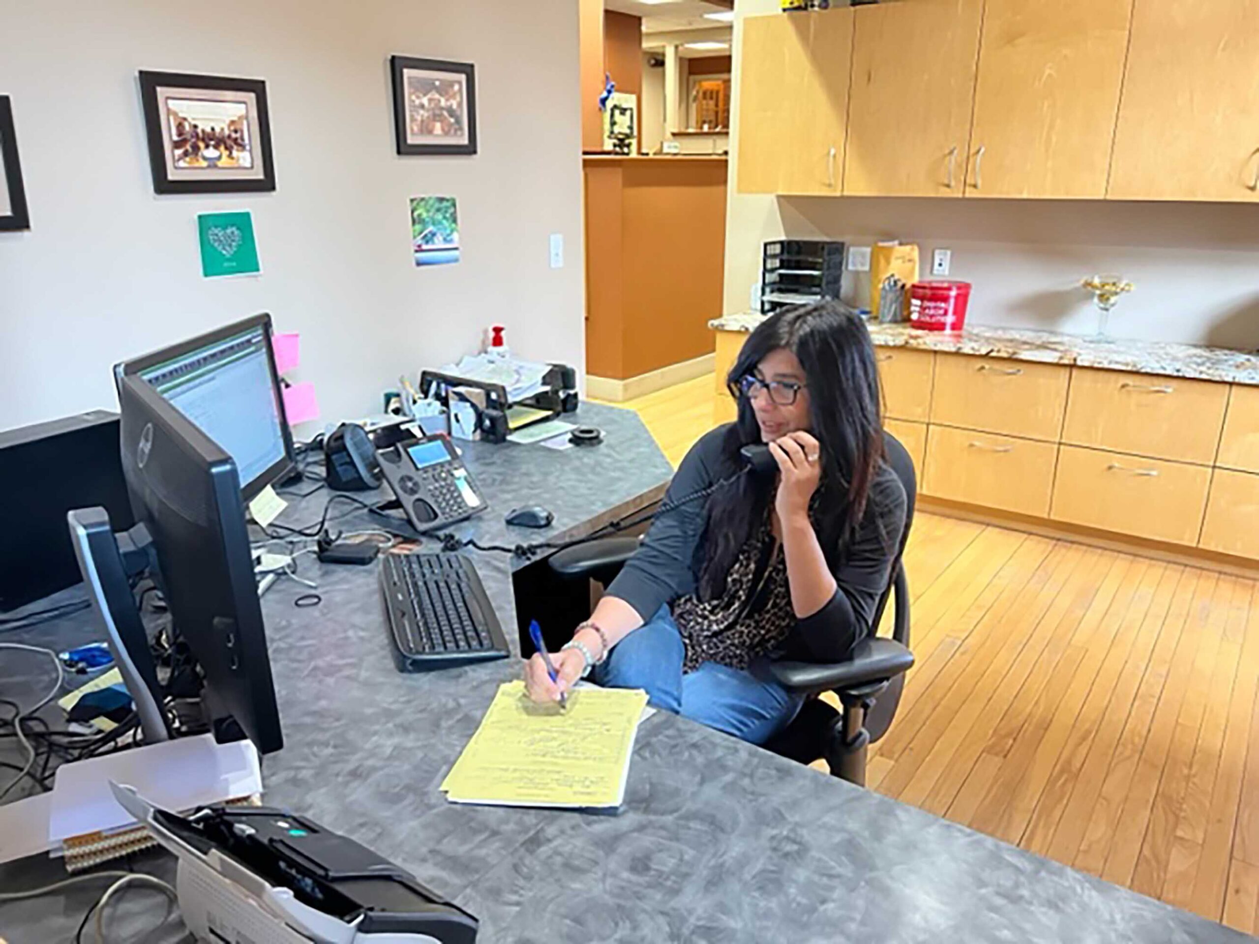
A short interview with GHH Office Manager Maria Latella lets you know how we can help you with your needs and goals. A GHH inquiry intake story:

What does a typical request look like?

Depends on the caller’s specific survey or engineering needs but most of the calls are for services related to residential property, commercial property, elevation certificates, additions, subdivisions or construction layout.

What kind of information do you need or are listening for during these conversations?

It starts with contact information, who a proposal should be sent to (it does vary depending on the situation), who will be responsible for financials, and finally, what is the purpose of the survey or engineering services.

What happens after gathering the basic information?   Does the conversation end or continue?

It might end with a brief description of what the client can expect for next steps or it might continue depending on input from the client.  For example, if a client is unsure of what specific type of survey is needed we can ask some questions about what they are trying to accomplish.  If they want to see where their boundaries are marked on the ground that is one type of survey.  If they are planning on improvements to the site, that is another kind of survey.  In addition to helping determine the type of survey needed, it’s a good chance to describe the value of each.

Is it difficult to get to that point in the conversation?  Do you listen for key words or specific scenarios the potential client is referring to?

We listen for key words such as “flood insurance” or “I live on the shore” which most likely relates to completing a flood certificate.  Or, phrases such as “ I want to do an addition” and“ We have land we want to subdivide” can help drive what type of service is needed and how we can help.   Most clients are not aware of the various types of surveys so we try to lead the conversation to narrow down the list in order to provide the most appropriate proposal we can from the start.

How do you leave off with a client?

I will always explain next steps, specify who will accomplish them (e.g. , a Licensed Land Surveyor or Professional Engineer) and when to expect communication.

What is your overall goal when speaking with a potential client?

The goal is to convey a sense of confidence, that we are patient, that we care about their request and care about their end goal.

What is one thing you want clients to know when they call Godfrey Hoffman Hodge LLC?

There are lots of way we can help with your needs/goals.  The more we communicate, the better, and faster we can help

Surveying An Entire City: The Case of Detroit

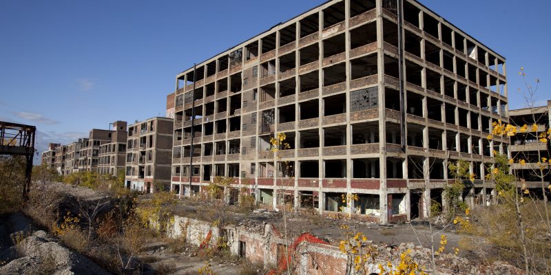
Detroit once bustled with business and manufacturing, but unlike many other cities of similar size, has seen population decline since the 1950s. As people left, and city blocks were abandoned, it became increasingly difficult to keep track of the over 400,000 parcels of land within its limits, especially with an antiquated computer system. It is estimated that there are some 80,000 or more abandoned buildings.

Continue reading “Surveying An Entire City: The Case of Detroit”

Boundaries, Improvements, and Peace of Mind

IMG 0694

Building is a high-cost investment that has the potential for a great return. However, along with the risks associated with such an investment, issues with the boundary of a property or it’s zoning or deed restrictions are known to cause headaches. Property disputes and unauthorized improvements are an expense that no one wants to bear.

When facing unauthorized improvements and boundary disputes, you require a surveyor’s assistance. The best time to seek this assistance is before you build as to resolve and prevent any issues curtailing the building itself and its profit at completion.

Boundaries

Boundary surveying confirms boundaries of your piece beforehand. Though existing features on your land may convey a boundary (for example, fences or a line of trees), the actual boundary can be quite different. If land is developed based on an assumed boundary, town or city officials will require you to remove the feature at fault or apply for a variance to clear up the issue.

Continue reading “Boundaries, Improvements, and Peace of Mind”

Setbacks, Easements and Density Restrictions… Oh My

peri urban residential resized 600Getting control of a piece of land for development is a big first step. However, just because you have the land and you have a vision for the building you want to construct doesn’t mean that you can always put the two together. What you’re going to be able to build — and where you built it — will get determined by what comes up on your survey.

Continue reading “Setbacks, Easements and Density Restrictions… Oh My”