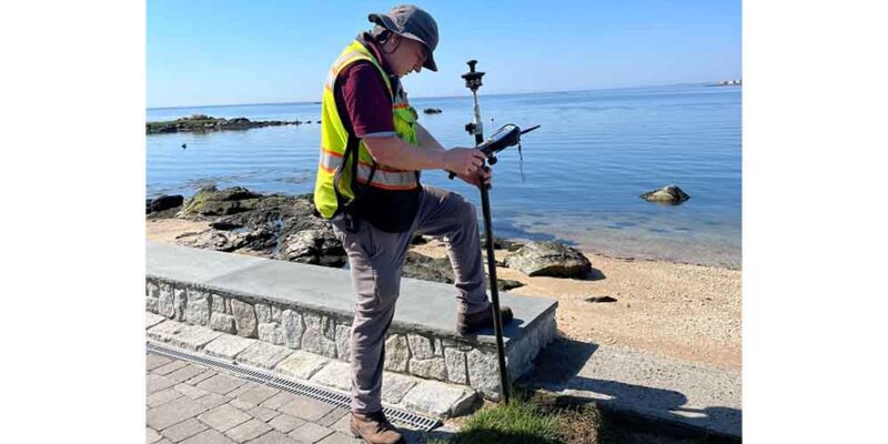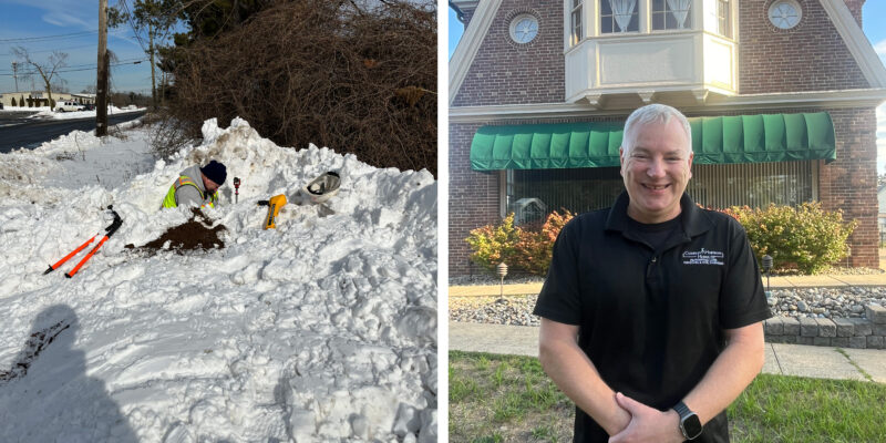
Hoffman began his surveying career back in 1978 when he worked for his uncle, Bernard Godfrey. After graduating from Paul Smith’s College, he worked his way from rod-man to transit-man and eventually party-chief. In 1988 when Adam received his Land Surveying license, he and Mr. Godfrey formed Godfrey-Hoffman Associates. After 12 years of a great partnership, Mr. Godfrey retired which left Mr. Hoffman with the entire business.

Employee Spotlight: Meet Marcus Puttock

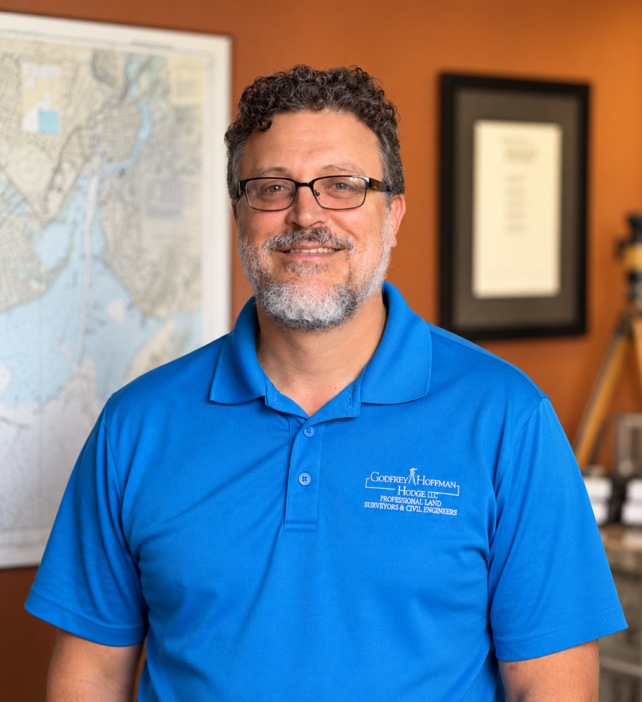
From initial site planning to final construction, successful projects require technical expertise, creative problem-solving, and a clear understanding of the land. As Director of Engineering at Godfrey Hoffman Hodge, Marcus Puttock brings all three to his work, drawing on his experience as both a licensed professional engineer and land surveyor.

For our latest Employee Spotlight, we caught up with Marcus to learn more about his role, the challenges of civil engineering, and what keeps him engaged after more than a decade with GHH.

Tell us a little about yourself and your time at GHH.

I’m Marcus Puttock, Director of Engineering at Godfrey Hoffman Hodge and a licensed professional engineer and land surveyor. I joined the firm in early 2015, so I’ve been part of the team for more than 11 years.

What does your role involve, and what do you enjoy most about it?

I primarily oversee civil engineering projects, from initial feasibility and site design through municipal approvals and construction. I enjoy solving practical problems and helping clients turn an idea into something that can actually be approved and built.

How do civil engineering and land surveying work together?

Surveying establishes property boundaries and documents existing site conditions. Civil engineering builds on that information to design proposed improvements.

Having a background in both disciplines helps me recognize potential issues early, understand the information we’re working with, and develop designs that respond to the actual conditions of a property.

What does a typical workday look like?

There really is no typical day. I might review plans and calculations, prepare proposals, meet with clients or municipal staff, visit project sites, answer questions from our engineering team, and attend an evening commission meeting. And that’s often across several different projects.

What’s the biggest challenge in your day-to-day work?

Balancing multiple active projects while responding to changing client needs, regulatory requirements, and deadlines. Every property and municipality presents different challenges, so even familiar project types require careful attention and sound judgment.

What’s changed the most during your career?

Technology has transformed nearly every aspect of our work. GPS, drones, CAD, GIS, digital modeling, and electronic submissions allow us to collect and evaluate much more information and develop plans more efficiently.

And what hasn’t changed?

The fundamentals. Accurate information, sound engineering judgment, attention to detail, and clear communication are just as important today as they’ve always been.

Technology helps us do the work, but it doesn’t replace professional experience or responsibility.

What keeps you motivated?

I enjoy the variety and the satisfaction of solving difficult problems. It’s rewarding to watch a project progress from an initial conversation through design and approvals, and ultimately into construction.
Surveying Explained: Answers to Five Common Questions

From property boundaries to zoning requirements, our team answers some of the questions we hear most often.

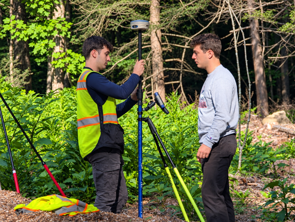
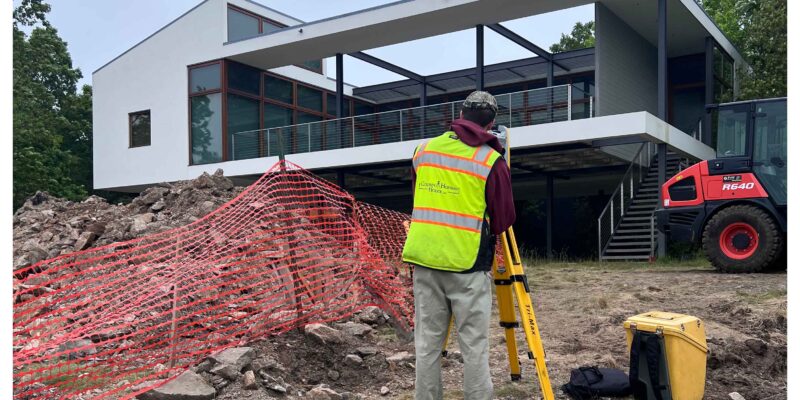
Land surveying plays an important role in property ownership, development, and construction. But for many property owners, the process isn’t always clear. Why does a surveyor need to examine an entire property when only one boundary is in question? What exactly is an A2 survey? And what is that instrument on the tripod?

At Godfrey Hoffman Hodge, we hear these questions regularly. Here are answers to five of the most common.

1. Can you survey just one property line? I only need one side marked.

It’s a reasonable question, especially when you’re planning a fence, landscaping, or another improvement along a single property boundary.

But determining the location of one property line generally requires understanding the boundaries of the entire parcel. Surveyors rely on historical records, existing monuments, field measurements, and calculations to establish how the pieces fit together.

While we can often limit the physical markings to the area you’re concerned about, we first need to establish the property’s boundaries as a whole. Certain exceptions may apply, particularly for larger parcels.

2. Will my survey be filed with the town?

Not necessarily. In Connecticut, completed surveys are not automatically filed with the municipality.

Some surveys are prepared for submission to a town’s planning or zoning department as part of a permitting or approval process. In other cases, a municipality may require a survey to be recorded in the land records.

There are also situations where we recommend that a property owner record a survey for future reference. The appropriate approach depends on the property and the purpose of the survey.

3. Is that a camera you’re using?

We get this one more often than you might think!

The instrument you see mounted on a tripod is likely a total station, a highly precise surveying instrument used to measure angles and distances.

With its eyepiece and tripod, it’s easy to see why someone might mistake it for a camera. But rather than taking photographs, a total station helps surveyors collect the measurements needed to establish property boundaries, map existing conditions, and support engineering and construction projects.

4. What is an A2 survey?

If you’ve been involved in a property transaction or zoning application in Connecticut, you’ve probably heard the term “A2 survey.”

In Connecticut, A-2 refers to a recognized class of horizontal survey accuracy. It’s a designation frequently referenced in municipal zoning regulations and land development requirements.

Unlike a map assembled from existing records or compiled mapping sources, an A-2 survey involves professional research, field measurements, and calculations to establish and document property information to the applicable accuracy standard.

The survey’s certified class of accuracy should be clearly identified on the map.

5. Why is the town requiring me to get a survey?

Municipalities often require surveys to verify that proposed improvements or activities comply with local zoning regulations.

Whether you’re planning an addition, installing a structure, or pursuing a larger development project, the town may need accurate information about property boundaries, setbacks, existing improvements, and other site conditions.

A survey provides the information municipal officials need to evaluate a proposal and determine whether it meets applicable requirements.

Understanding Your Property Starts with the Right Information

Every property has its own history, characteristics, and considerations. A professional land survey helps bring those details into focus, providing reliable information for decisions about ownership, improvements, and development.

Have a question about your property or an upcoming project? The team at Godfrey Hoffman Hodge is here to help.

Timing Is Everything: Why the First Call Can Make All the Difference

Every successful project starts with an idea.

Whether it’s a new commercial development, an addition to your home, a property purchase, or a site redevelopment, the excitement usually begins with a vision of what’s possible. The next call is often to an architect, builder, or contractor to begin discussing concepts, layouts, and budgets.

What many property owners don’t realize is that one of the most important pieces of the process often comes later than it should.

The survey.

By the time a surveyor is contacted, project schedules have frequently already been established, expectations have been set, and everyone is eager to move forward. Unfortunately, that’s often the point where reality begins to catch up with the timeline.

A professional survey provides the foundation for everything that follows. Property boundaries, easements, existing conditions, utilities, topography, wetlands, and other site characteristics all influence what can ultimately be designed, permitted, and built. Without that information, design decisions may be based on assumptions that later need to be revisited.

Once the survey is complete, engineers can begin preparing plans that satisfy local zoning requirements, municipal regulations, and site constraints. From there, plans are submitted for review, comments are addressed, revisions are made, and approvals are secured before construction can begin.

It’s a process that takes time.

When surveying and engineering services are brought into the conversation early, project teams have the information they need to make informed decisions from the beginning. Potential challenges can often be identified before they become costly delays, allowing schedules and budgets to be developed with greater confidence.

The same principle applies to real estate transactions. Closing dates are often established before anyone considers whether a property survey is required. When that happens, surveyors are asked to meet deadlines that may simply not reflect the time needed to complete accurate, professional work.

There is no substitute for good planning.

Every project is unique, but one lesson remains remarkably consistent: the earlier survey and engineering professionals become part of the conversation, the smoother the path tends to be from concept to construction.

Investing in Our People: The Value of Professional Certification

At Godfrey Hoffman Hodge, we believe the quality of every project begins with the people behind it.

Surveying is a profession built on precision, experience, and continuous learning. As technology and industry standards evolve, so does the need for ongoing professional development. That’s why we encourage our team members to pursue opportunities such as the National Society of Professional Surveyors’ Certified Survey Technician (CST) program.

The CST program helps survey professionals strengthen their technical knowledge, sharpen problem-solving skills, and build confidence in the field. More importantly, it reinforces a commitment to accuracy, professionalism, and continual improvement.

For our clients, that investment translates into knowledgeable professionals who are better equipped to anticipate challenges, communicate effectively, and provide the accurate information that serves as the foundation for successful projects.

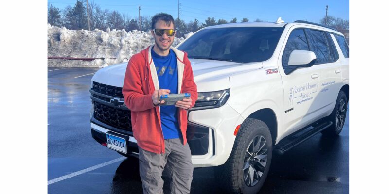
Calvin Weingart (pictured above), Godfrey Hoffman Hodge’s COO, recently renewed his National Society of Professional Surveyors Certified Survey Technician (CST) Level III Boundary certification. Originally earning the certification in 2005, Calvin has maintained it throughout his career because of his strong belief in the value of professional development and industry standards. His commitment extends beyond his own certification—he also serves on the Connecticut Association of Land Surveyors (CALS) Education Committee, where he actively encourages surveying technicians to pursue the CST program. Calvin’s leadership reflects Godfrey Hoffman Hodge’s ongoing investment in its people and its commitment to fostering a culture of learning, professional growth, and excellence for the benefit of every client we serve.

A Look Back: The Tools That Shaped Surveying

National Surveyors Week (March 15-21 2026) gives us a chance to recognize the profession and provides a moment to look back at how far the work has come.

Before GPS units, robotic total stations, and digital workflows, surveying relied on precision, patience, and some surprisingly hands-on tools. A few pieces of historic equipment tell that story better than anything.

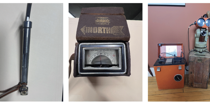
From left to right, the following tools and their purpose is described below.

MEASURING DISTANCE BY FEEL
Primary use: late 1800s – 1980s
One of the simplest but most critical tools was the Tape Tension Scale, or spring balance. Surveyors used steel tapes to measure distance, but those tapes could stretch depending on how hard they were pulled.

To keep measurements consistent, surveyors would apply a specific amount of tension—often between 10 and 20 pounds—using the scale. It was a small step, but essential for accuracy, accounting for stretch, sag, and even temperature.

Today, distance is captured instantly with electronic instruments—but it used to depend on steady hands and careful control.

READING THE EARTH’S MAGNETIC FIELD
Primary use:
1700s – early 1900s (surveying/geophysical crossover)
Another fascinating tool is the Dip Needle, which measured the vertical angle of Earth’s magnetic field—something a standard compass can’t do.

Surveyors and early geophysical explorers used it to detect magnetic anomalies, locate iron deposits, and even find buried objects. It was an early example of using science to “see” what couldn’t be seen above ground.

Modern surveyors achieve similar goals with magnetic locators and advanced detection tools—but the principle remains the same.

THE SHIFT TO ELECTRONIC PRECISION
Primary use:
~1950s – 1980s
The introduction of Electronic Distance Measurement (EDM) marked a turning point in the profession.

Instead of relying on chains or tapes, EDM instruments used light waves to calculate distances with far greater speed and accuracy. Surveyors could send a signal to a reflector and measure distance based on the return—laying the groundwork for the total stations we rely on today.

It’s hard to overstate how transformative this was. What once took hours could now be done in minutes—with better results.

FROM THEN TO NOW
Surveying has always been about precision—but the tools have evolved dramatically.

What hasn’t changed is the role surveyors play in shaping the built environment. Whether using a steel tape or satellite positioning, the goal is the same: establish reliable data that projects depend on from day one.

As we recognize National Surveyors Week, it’s worth appreciating both where the profession is today—and the tools that helped get it here.

Welcoming RJ Phiambolis to GHH

We’re excited to welcome RJ Phiambolis to the GHH team. RJ brings five years of field experience and a strong, hands-on approach to surveying. As a Survey Party Chief, RJ plays a key role in delivering the precision and reliability our clients depend on—day in and day out in the field.

Here is a quick Q&A with RJ to give you a look into his path into surveying, what drives his work, and what a typical day in the field really looks like.

Who are you and how long have you worked at Godfrey Hoffman Hodge?
RJ Phiambolis.  I started at GHH December 8, 2025 but have been in the career field for about 5 years.

How did you get into the career field of surveying?
After completing a four-year enlistment in the US Navy, I was looking for a job.  I was familiar with surveying from my undergrad major, Geo-Environmental Sciences, so when I saw a job opening for a survey tech in the New Haven area, I applied and was hired.

What do you do and why do you do it?
Survey party chief.  I do it for gainful employment and for the independent nature of the work.

What does a typical day look like for you?
Arrive at the office at about 8 in the morning, organize gear, files and mission briefing, then off to the field for the day.  I return to the office around 3 in the afternoon to download data, debrief with my supervisor, and put the batteries on the charger for the next day.

What is challenging about your day to day?
Too much traffic, other drivers, ticks and poison ivy.  Operating in challenging terrain while carrying too much gear.

What has changed during your career?
On a personal level, my “survey sense” or “site sense” has developed to where I recognize the nuances of a site much quicker which helps me get the job done more efficiently and with confidence.

What hasn’t changed?
Dead batteries at the worst possible time, tripods going out of level during last winter, chopping line and finding lost equipment such as hammers that fall out of stake bags.

What keeps you going back?
A steady paycheck!  Aside from that, outside work, working solo, being responsible for the field mission.

Erosion, Elevation and Everything In Between: Why Site Surveys Are The Backbone Of Stormwater Design

Before the first pipe is laid or the first shovel hits the ground, every successful stormwater management plan begins with one thing — precise, reliable survey data. At Godfrey Hoffman Hodge, our survey and mapping expertise forms the foundation that civil engineers rely on to design systems that protect properties, prevent flooding, and preserve the environment.

A topographic survey does more than map contours. It uncovers the subtle variations in elevation that dictate how water moves across a site — where it collects, how it drains, and where intervention is needed. These details empower engineers to design drainage systems that perform efficiently and meet every local, state, and federal standard.

Surveying also plays a critical role in erosion and sediment control. By capturing existing grades, soil conditions, and watershed boundaries, our data informs design decisions that prevent runoff from damaging nearby properties or reaching sensitive wetlands and waterways. From the placement of swales and retention basins to the sizing of culverts and storm drains, accurate survey data drives smart design.

Whether for new developments, roadway improvements, or campus expansions, accurate survey information reduces risk, saves time, and prevents costly field changes. It’s foresight you can measure — in smoother projects, safer outcomes, and lasting value.

At GHH, we combine time-tested surveying skill with cutting-edge technology — GPS, robotic instruments, 3D laser scanning, and drone mapping — to deliver data our clients can trust. Because when it comes to stormwater design, success isn’t just measured in cubic feet per second — it’s measured in foresight, precision, and partnership.

Meet Kevin Gallagher, A Hodge Original…

At Godfrey Hoffman Hodge (GHH), our strength lies in the people who bring expertise, history, and dedication to every project. Few embody this more than Kevin Gallagher, one of the original members of the Hodge survey team acquired by Adam Hoffman in 2010. With nearly four decades of experience in the field, Kevin has witnessed firsthand how surveying has evolved—while the principles at its core have remained constant. In this interview, he shares insights from his career, what makes his work rewarding, and the challenges and changes that continue to shape the surveying profession today.

Who are you and how long have you worked at Godfrey Hoffman Hodge?
Kevin Gallagher, Last of the original employees from the “Hodge” survey team Adam purchased in 2010.

What do you do and why do you do it?
Currently I manage the survey office and survey duties in the Unionville office. I enjoy the variety of projects and interaction with our client base.

 What does a typical day look like for you?
Luckily there isn’t a typically day, from doing wetland flag locations a boundary stakeout to being on a roof locating steel framing to retro fit an additional…. It never seems typical.

What is challenging about your day to day?
The biggest challenge is making sure our clients who are unfamiliar with what a surveyor does has a clear understanding of what is required for their specific project .

What has changed during your career?
EVERYTHING!  Started surveying in 1985 just before the introduction of EDM’s.  So I started with a transit, steel tape, rod and note book.  Now its robotic total station & GPS. If George Washington could see us now.

What has not changed?
Understanding that even though the technology has change, the principle have not.

What keeps you going back?
The challenges of each project and the clients we work with.

Understanding Town GIS Portals: What Those Lines Really Mean

These days, most towns host online GIS (Geographic Information System) portals that let residents explore property lines, zoning, and other local data with just a few clicks. They’re usually very user-friendly and give users a sense of confidence in what they see. But appearances can be deceiving.

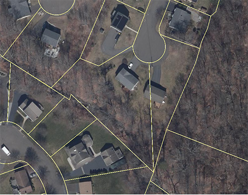
You might notice a lot where a line appears to cut straight through the middle of a house—or lots where the lines seem to fall neatly around the property. Surprisingly, there’s no difference in terms of accuracy. In fact, all the lines on these maps are approximate, and most GIS sites include a disclaimer stating as much. Many users overlook the small print and assume the lines are precise.

For example, in one neighborhood, (see above),  a GIS map shows a line slicing right through a home. Having worked in the area, I can confirm that the depiction is not accurate—it’s no more correct than lines that appear properly aligned. These maps are meant to give a general sense of property boundaries, not survey-level precision.

This distinction becomes especially important when clients reach out about survey needs. We often take the time to explain that assessor lines are compiled from various sources and are not the result of a professional survey. While GIS portals are a useful starting point, resolving property line questions always requires a licensed professional.

Bottom line: GIS maps are a great tool for exploration, but when it comes to legal property boundaries, trust a surveyor—not a screen.

Looking Ahead: A Leadership Update at GHH

From Field Dog to Big Dog…

As many of you know, our firm recently celebrated its 100th year in business — a milestone that speaks to the strength of our people, our reputation, and the trust of our clients. Today, we’re excited to share an update about the leadership that will carry GHH into its next chapter.

After nearly fifty years with the company, Adam Hoffman has decided it’s time to step back from the day-to-day operations. While Adam will remain actively involved in guiding the firm at a strategic level, this transition allows him to focus more on long-term planning while ensuring that the daily operations are in experienced hands. Adam’s decades of leadership have shaped GHH into the strong, resilient firm it is today, and his influence will continue to be felt well into the future.

Taking the reins of daily management is someone who needs no introduction — Calvin Weingart, L.S. Calvin has been the backbone of our company for close to thirty years. From his early days in the field to his leadership across major projects, Calvin’s dedication, expertise, and steady hand have been essential to GHH’s success. For clients and colleagues alike, he represents the reliability and excellence that define who we are.

This is not just a change in roles — it’s the natural evolution of a partnership built on trust, experience, and a shared commitment to our clients. We extend our sincere congratulations to both Adam, for nearly five decades of stewardship, and to Calvin, for stepping into this leadership role with the full confidence of our team.

We look forward to continuing to serve you with the same dedication, accuracy, and integrity that have defined GHH for more than a century.