GHH Celebrates 100 Years of Quality & Accuracy!

Building on Trust, Delivering Results:
Godfrey Hoffman Hodge Celebrates 100 Years!

We’re pleased to share the news of this milestone and look forward to continuing to do what we’ve been doing for a century: providing our clients with fast, accurate and quality services. Here’s a brief history of how we got here:

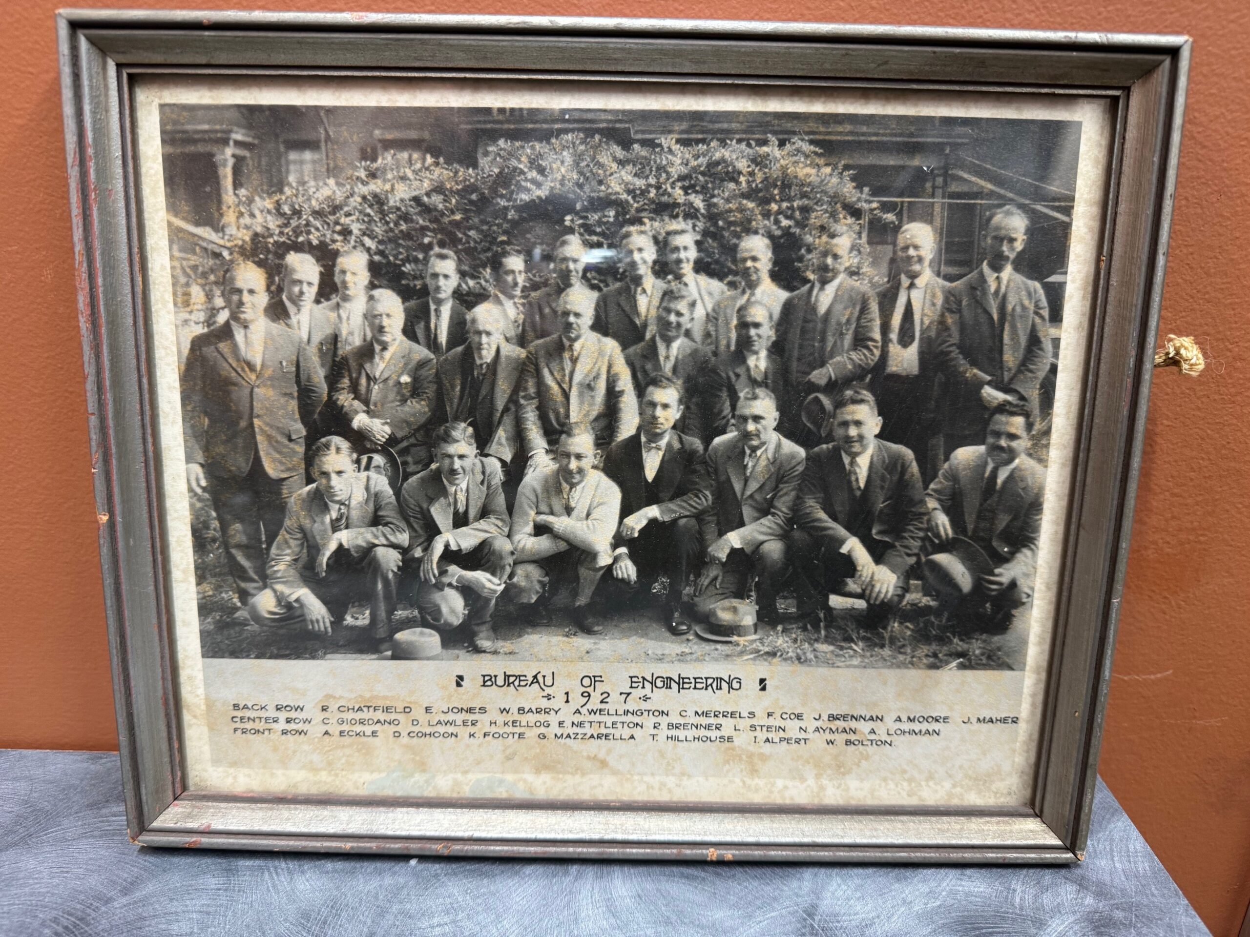
1924: The story begins when two young engineers, recent Yale graduate Lewis Stein and Constantine “Gus” Giordano meet while working for the City of New Haven Engineering Department. Together, they set out on their own and forge a partnership in New Haven, laying the foundation for a legacy in land surveying.

Bernard Godfrey enters the scene. While still in high school, he learns the ropes under Stein & Giordano’s guidance, igniting a lifelong passion for the field. His journey takes him through forestry, entrepreneurship, and back to surveying, eventually marrying Stein’s niece and taking over the firm in 1960.

Enter the next generation: Adam Hoffman, Godfrey’s nephew, joins the firm in 1977, inheriting the family’s dedication to precision and service. He expands his expertise with a forestry degree and land surveying minor, rising through the ranks before becoming a partner in 1988. The firm rebrands as Godfrey-Hoffman Associates.

The 2000s usher in expansion. Godfrey retires in 2000, and Hoffman restructures, solidifying the company’s future as a Limited Liability Company. The firm ventures into engineering with the addition of Victor Benni in 2001, further diversifying its offerings.

2010 marks a pivotal moment. Hoffman acquires Hodge Surveying, a Farmington Valley mainstay since 1925. This strategic move broadens the company’s reach and expertise.

Finally, in 2019, the two entities merge to become Godfrey Hoffman Hodge, LLC. This marks a culmination of nearly a century of dedication, bringing together 100 years of combined experience in land surveying and engineering.

Today, Godfrey Hoffman Hodge stands as a full-service powerhouse. We tackle projects across Connecticut, serving public, private, commercial, residential, and industrial clients. Our commitment to quality, accuracy, and cutting-edge technology ensures every project receives the attention it deserves.

How Land Surveyors Set The Stage For A New Building

This Is How We Do It…

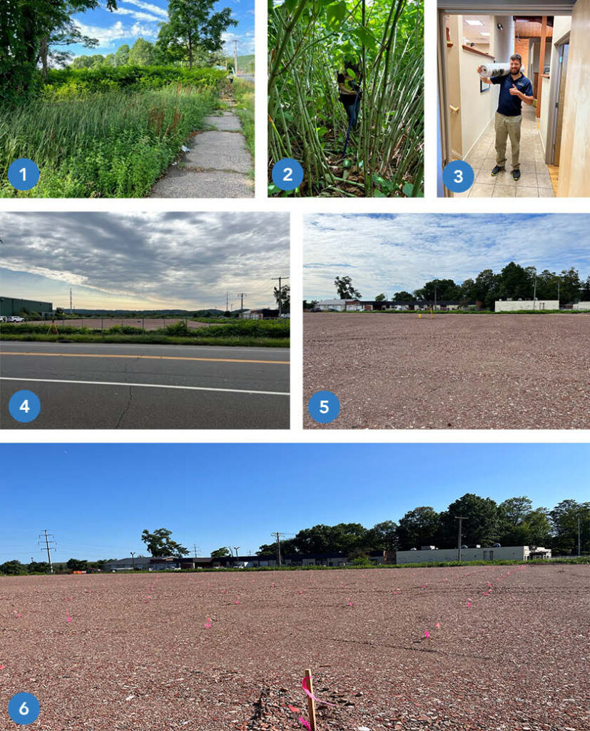
This sequential photo montage highlights all the phases involved in preparing a site for the construction of a new building.

  1.  The undeveloped, overgrown site in Hamden, CT at commencement of survey work.
  2.  Site conditions during field work with survey gear.  As we often do, our crew contends with towering, tangling vegetation.
  3.  A year later, after site design and the permitting process, the finished plan set is delivered to the town permitting agency.
  4.  The site is cleared and prepared for construction.
  5.  The crew and survey instrument are in position to locate and mark 384 points for Helical Pile installation.  (These piles, or piers, are used to stabilize soil to support the building foundation).
  6.  The pier stakeout is complete and the site is ready for the pile driving crew to commence work. Each location is identified by the  pink whisker flag and orange numerical identifier.

Once the piers are installed the foundation will be marked out for construction.

Stay tuned for updates as we follow this project to completion!

Tales From The Front Desk

How GHH Helps When You Call…

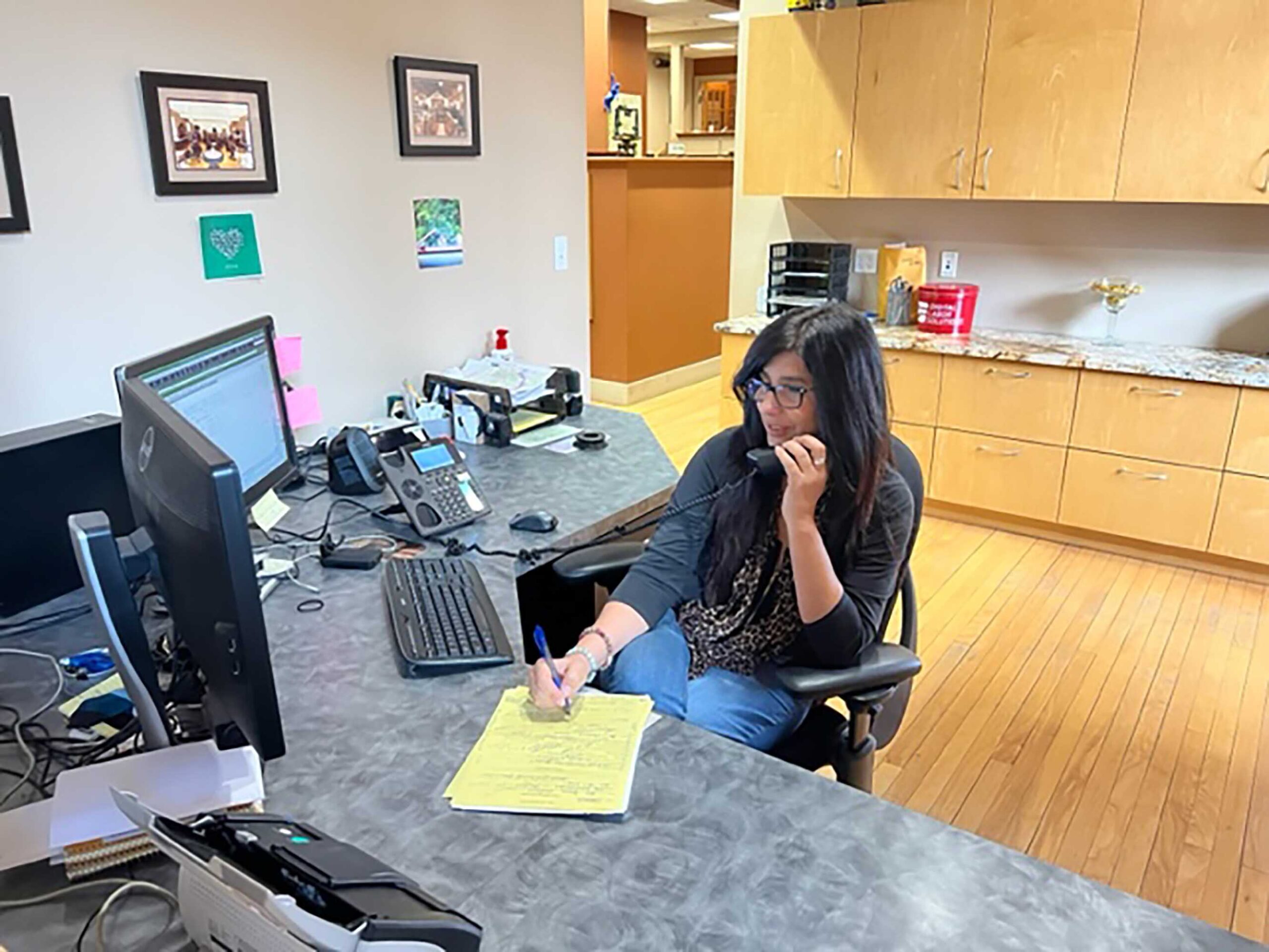
A short interview with GHH Office Manager Maria Latella lets you know how we can help you with your needs and goals. A GHH inquiry intake story:

What does a typical request look like?

Depends on the caller’s specific survey or engineering needs but most of the calls are for services related to residential property, commercial property, elevation certificates, additions, subdivisions or construction layout.

What kind of information do you need or are listening for during these conversations?

It starts with contact information, who a proposal should be sent to (it does vary depending on the situation), who will be responsible for financials, and finally, what is the purpose of the survey or engineering services.

What happens after gathering the basic information?   Does the conversation end or continue?

It might end with a brief description of what the client can expect for next steps or it might continue depending on input from the client.  For example, if a client is unsure of what specific type of survey is needed we can ask some questions about what they are trying to accomplish.  If they want to see where their boundaries are marked on the ground that is one type of survey.  If they are planning on improvements to the site, that is another kind of survey.  In addition to helping determine the type of survey needed, it’s a good chance to describe the value of each.

Is it difficult to get to that point in the conversation?  Do you listen for key words or specific scenarios the potential client is referring to?

We listen for key words such as “flood insurance” or “I live on the shore” which most likely relates to completing a flood certificate.  Or, phrases such as “ I want to do an addition” and“ We have land we want to subdivide” can help drive what type of service is needed and how we can help.   Most clients are not aware of the various types of surveys so we try to lead the conversation to narrow down the list in order to provide the most appropriate proposal we can from the start.

How do you leave off with a client?

I will always explain next steps, specify who will accomplish them (e.g. , a Licensed Land Surveyor or Professional Engineer) and when to expect communication.

What is your overall goal when speaking with a potential client?

The goal is to convey a sense of confidence, that we are patient, that we care about their request and care about their end goal.

What is one thing you want clients to know when they call Godfrey Hoffman Hodge LLC?

There are lots of way we can help with your needs/goals.  The more we communicate, the better, and faster we can help

Tales From The Field

Recent Work Had Us Surveying Wetlands and Coastline

Cows, Drones and Projects in the News…

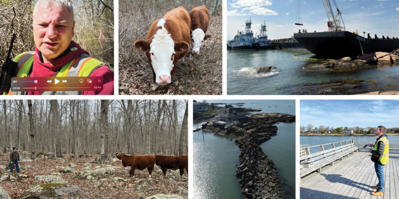
Calvin Weingart surveyed wetlands in North Stonington – he was greeted by a few wandering cows on this assignment.

Zach Weingart provided a drone survey for the Sachem’s Head Yacht Club where a grounded barge had to be removed from the breakwater. An article in the New Haven Register provides the backstory in further detail – link here to read about it.

Commonly Overlooked Factors When Assessing a Property

When selecting a prospective house or patch of land, most people are easily enticed by the usual factors like location, size, price and even structural design. But acquiring a property means that you need to be mindful of even the tiniest details. Otherwise, you might face unexpected conflicts or the value of your new property may be badly affected later on.

Continue reading “Commonly Overlooked Factors When Assessing a Property”

How to Distinguish Your Property Line

Property Lines CTThe ability to determine the boundaries of a property is very useful, particularly for homeowners and developers who are planning to improve and expand their structures.

Finding these property lines is important for those who want to defend their homes from boundary encroachments and homeowners should also know their exact location in order to maintain the complete value of their property.

Continue reading “How to Distinguish Your Property Line”

Boundaries, Improvements, and Peace of Mind

IMG 0694

Building is a high-cost investment that has the potential for a great return. However, along with the risks associated with such an investment, issues with the boundary of a property or it’s zoning or deed restrictions are known to cause headaches. Property disputes and unauthorized improvements are an expense that no one wants to bear.

When facing unauthorized improvements and boundary disputes, you require a surveyor’s assistance. The best time to seek this assistance is before you build as to resolve and prevent any issues curtailing the building itself and its profit at completion.

Boundaries

Boundary surveying confirms boundaries of your piece beforehand. Though existing features on your land may convey a boundary (for example, fences or a line of trees), the actual boundary can be quite different. If land is developed based on an assumed boundary, town or city officials will require you to remove the feature at fault or apply for a variance to clear up the issue.

Continue reading “Boundaries, Improvements, and Peace of Mind”

Bamboo-zled! State Holds Property Owners Accountable for Bamboo Growth

Bamboo 1 resized 600Within Connecticut, planting of bamboo has become popular, particularly along coastal areas. However, most are unaware of how quickly and extensively bamboo can spread, and hence, the new liabilities property owners assume when planting.

The particular type of bamboo under scruitiny is known to regulators as “running bamboo.” Though not considered an invasive species in Connecticut, it has a root system that is particularly adept at spreading underground, and if not carefully maintained, will spread from one property to another. According to an article published February 17th on OrangeLive.com, the “bamboo roots spread and travel underground far from the visible plants and new shoots can pop up just about anywhere. They are strong enough to tear up patios and foundations and destroy septic systems.”

Continue reading “Bamboo-zled! State Holds Property Owners Accountable for Bamboo Growth”