How Land Surveyors Set The Stage For A New Building

This Is How We Do It…

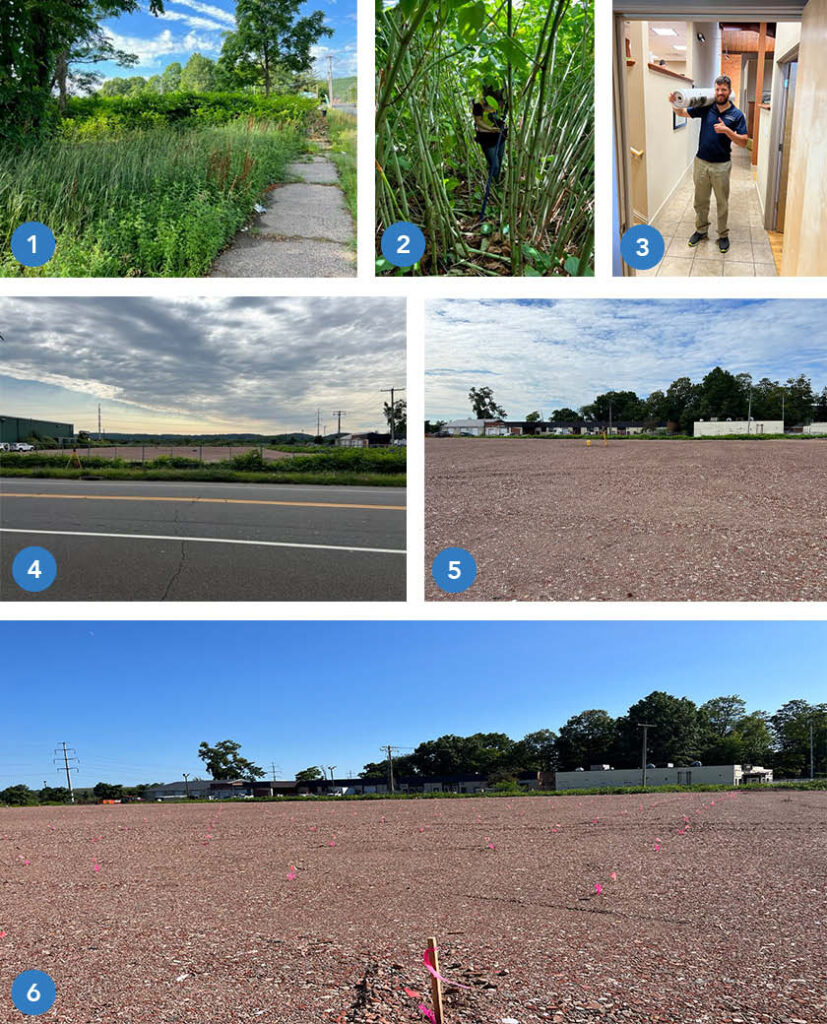
This sequential photo montage highlights all the phases involved in preparing a site for the construction of a new building.

  1.  The undeveloped, overgrown site in Hamden, CT at commencement of survey work.
  2.  Site conditions during field work with survey gear.  As we often do, our crew contends with towering, tangling vegetation.
  3.  A year later, after site design and the permitting process, the finished plan set is delivered to the town permitting agency.
  4.  The site is cleared and prepared for construction.
  5.  The crew and survey instrument are in position to locate and mark 384 points for Helical Pile installation.  (These piles, or piers, are used to stabilize soil to support the building foundation).
  6.  The pier stakeout is complete and the site is ready for the pile driving crew to commence work. Each location is identified by the  pink whisker flag and orange numerical identifier.

Once the piers are installed the foundation will be marked out for construction.

Stay tuned for updates as we follow this project to completion!

Tools From The Field

Accuracy Matters.

We incorporate the latest tools and technology in pursuit of capturing robust surveying data in the most efficient manner – all for the benefit or our clients.

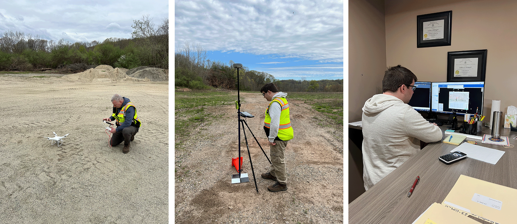
Here, Calvin Weingart enters flight data and commences a drone flight. Utilizing this tool gives the ability to augment data collection on sites. In this case we are doing so in Wallingford and East Haven, CT.

Once the flight is complete, team member Ben Weingart monitors the collection of GPS data on a ground control point. This data allows the team to precisely relate ground positions to target locations captured by the drone. Once the field work is done, Ben works in the office to perform the corrections and commence processing.

Accuracy Matters – we have the tools and know-how to help with all your surveying needs.

GHH Supports Future Surveyors

Lyman Hall Launches Survey Module

GHH is pleased to play our part in this new and exciting program…

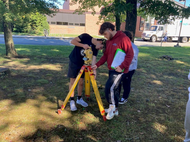
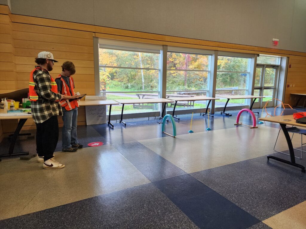
In September 2022, Lyman Hall High School in Wallingford launched a surveying module in the Agriculture Science Department. The objective of the one semester course is to provide exposure to the career field and basic skill training. Students who take the course are immersed in basic surveying, mapping concepts and introduced to the standards of work and expectations for the surveying profession.

Throughout the course students gain skills in operating tools for land measurement, reading and making maps, operating unmanned aerial systems (drones), to collect remote sensing data, researching land records, and manipulating data in software such as AutoCAD, Access, Pix4D, and Carlson Photo Capture.  Assignments are associated with real world scenarios. To support the technical side, a wide range of surveying equipment and software was procured through two separate Perkins Career and Technical Education Grants. Students will have opportunities to get hands-on instruction and experience with set up and operation of total stations, data collectors, prism poles, tripods, GPS rovers, RTK and non-RTK UAVs.

Curriculum development was supported by The Institute Of Real World Education and Curriculum Advancement (IRWECA) at Southern Connecticut State University.  The objective of IRECA is for the interdisciplinary educator teams to be able to “develop and implement interdisciplinary curriculum modules aligned with industry needs and best practices in education.” (https://biopath.southernct.edu/irweca)  The team for Lyman Hall consists of Emily Picard,  Wildlife Biology teacher from the Agriculture Science Department,  Ryan Sheehan, Engineering STEM teacher  from the Science and Technology Department, Marjorie Drucker, curriculum facilitator from Drucker Educational Consulting LLC and Calvin Weingart, a licensed surveyor with Godfrey Hoffman Hodge LLC filling the role of industry consultant.

The team has met monthly since January 2022 to share ideas and goals, learn about the surveying profession and ultimately support the development of the curriculum now underway. We are confident that these high school students will come away from the course with the knowledge that the surveying career field is relevant, accessible and intriguing.  Ultimately, the hope is that the students will bring their youthful enthusiasm and passion for learning to the surveying profession.

We are glad to be a part of this exciting program – it’s always a thrill to share our knowledge and help push the profession forward!

Tales From The Field

Recent Work Had Us Surveying Wetlands and Coastline

Cows, Drones and Projects in the News…

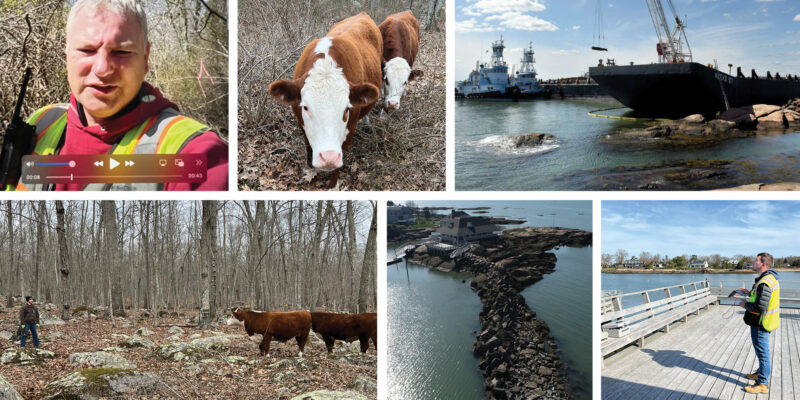
Calvin Weingart surveyed wetlands in North Stonington – he was greeted by a few wandering cows on this assignment.

Zach Weingart provided a drone survey for the Sachem’s Head Yacht Club where a grounded barge had to be removed from the breakwater. An article in the New Haven Register provides the backstory in further detail – link here to read about it.

Senator Cory Booker To Introduce Commercial Drone Legislation Following FAA’s Amazon Ruling

U.S. Senator Cory Booker is set to introduce legislation to establish temporary rules to govern the commercial use of drones that could greatly expand the ability of companies to fly unmanned vehicles, according to documents obtained by FORBES.

Continue reading “Senator Cory Booker To Introduce Commercial Drone Legislation Following FAA’s Amazon Ruling”

Aerial Mapping and Surveying

aerial

In September of 1885, two men climbed aboard a hot air balloon and embarked on a journey across the state of Connecticut. Alfred Moore and John Doughty drifted across the state, snapping pictures of the landscape as they traveled. The collection of thousands of photographs created a enormous picture of the state. This is a process known as aerial surveying, which is one of the many types of land surveying. Aerial surveying and mapping is an important step in land development and identification, it is used for planning waterways and highways, and finding areas for building development.

When to Use an Aerial Survey

There are several different reasons to have aerial mapping and surveying done. Many times, when a section of land is examined, the layout of the land is not clearly visible. When a natural disaster such as a hurricane, forest fire, or tornado devastates an area, an aerial survey is performed by using an aircraft to take aerial photos of the damage. This survey is used to determine the total amount of damage that has occurred. Construction and land development companies also use aerial mapping. When new roads are in the process of being built, an aerial survey provides photographs of the proposed route of travel, or of the suggested build site, and identifies any obstacles such as rivers, difficult terrain, and property boundaries that are in the projected path.

The most common way to take aerial photographs is by using satellite imagery. The satellite generated photos have proven to produce the highest quality picture, available in 2 or 3-D to provide a detailed view of the land.

Continue reading “Aerial Mapping and Surveying”