These days, most towns host online GIS (Geographic Information System) portals that let residents explore property lines, zoning, and other local data with just a few clicks. They’re usually very user-friendly and give users a sense of confidence in what they see. But appearances can be deceiving.
You might notice a lot where a line appears to cut straight through the middle of a house—or lots where the lines seem to fall neatly around the property. Surprisingly, there’s no difference in terms of accuracy. In fact, all the lines on these maps are approximate, and most GIS sites include a disclaimer stating as much. Many users overlook the small print and assume the lines are precise.
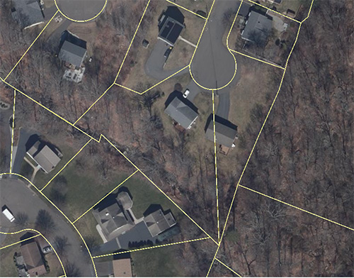
For example, in one neighborhood, (see above), a GIS map shows a line slicing right through a home. Having worked in the area, I can confirm that the depiction is not accurate—it’s no more correct than lines that appear properly aligned. These maps are meant to give a general sense of property boundaries, not survey-level precision.
This distinction becomes especially important when clients reach out about survey needs. We often take the time to explain that assessor lines are compiled from various sources and are not the result of a professional survey. While GIS portals are a useful starting point, resolving property line questions always requires a licensed professional.
Bottom line: GIS maps are a great tool for exploration, but when it comes to legal property boundaries, trust a surveyor—not a screen.